TTSK-D01 Fixed UAV Detecting and Locating System
Stable Outdoor Stationary Device for Long-Term Field Deployment
Product Overview
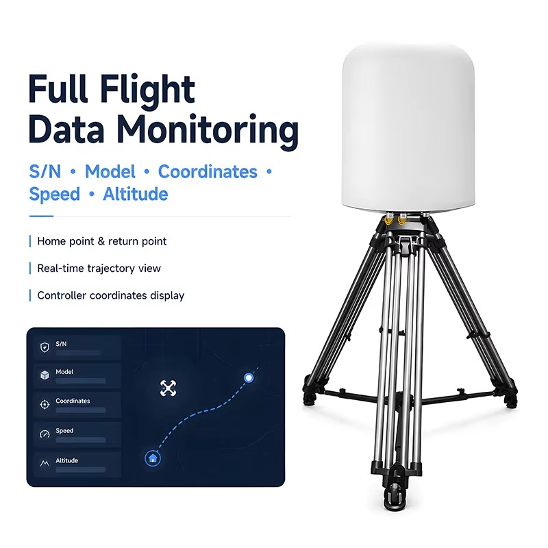
TTSK‑D01 is stationary signal detecting and locating equipment built for long-term outdoor setup. It receives UAV wireless signals passively to acquire device serial code, geographic coordinates, flying speed, takeoff point and remote controller location data. Supporting standalone offline running and multi-unit network grouping, it can connect with peripheral matching equipment to build complete regional protection setup. The unit works steadily round-the-clock under varied climate, widely adopted for important premises, airport surroundings and boundary site setup.
Technical Specifications
- Detectable UAV Types: DJI, Autel, Hubsan, FPV, Tello and homemade aircraft
- Working Frequency:100MHz~6000MHz
- Effective Range:1~10km | Max detect height:0~1000m
- Concurrent Target Quantity:≥5 units
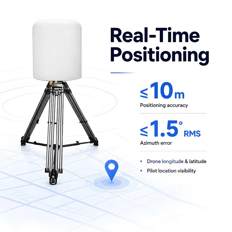
- Position Precision:≤10m | Azimuth error ≤1.5°
- Response Time:≤5s | Successful identification rate≥95%
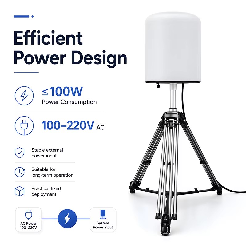
- Power Input:AC100~220V | Total power ≤100W
- Host Weight:≤15kg | IP Rating:IP65
- Operating Temp:-20℃~+65℃
Key Features
- Passive signal receiving without outward signal emission
- Recognize mainstream UAV brands including DJI, Autel, FPV and DIY models
- Effective locating range from 1km to 10km depending on surroundings
- Pinpoint both drone and remote pilot position within ≤10m precision
- Identify up to 5 targets simultaneously with separate position marking
- Built-in allow/block list to skip alert for permitted aircraft
- Visible & audible prompt once unauthorized aircraft access
- Store historical detection logs and support multi-style data analysis via charts
- Compatible with multiple electronic map platforms
- IP65 casing, -20℃~65℃ working range for all-weather outdoor use
- Supports cascading networking and linkage with auxiliary hardware
Product Image


Application Scenarios

Manufacturer Information


Frequently Asked Questions
FAQ 1
Q: Does this drone detection equipment emit electromagnetic signals during operation?
A: No, it adopts fully passive detection technology without transmitting any electromagnetic waves, zero electromagnetic pollution, and will not interfere with surrounding communication equipment.
FAQ 2
Q: What drone brands and models can this device identify?
A: It supports mainstream UAVs including DJI series, Autel, FPV traversing drones, Xiaomi, Hubsan, Tello, self-assembled WiFi drones and most consumer & industrial UAVs on the market.
FAQ 3
Q: What is the maximum effective detection distance of the equipment?
A: Under open unobstructed environments, the detection distance can reach up to 10km; the actual distance will fluctuate slightly according to terrain, building shielding and electromagnetic environment.
FAQ 4
Q: Can the device locate both drones and remote control operators?
A: Yes, it can capture longitude, latitude, azimuth and real-time distance data of both the flying drone and the pilot’s remote controller simultaneously.
FAQ 5
Q: How many UAV targets can the equipment track and display at the same time?
A: It can detect more than 5 drone targets simultaneously, and support real-time display & trajectory playback for over 5 flight paths at the same time.
FAQ 6
Q: Can this equipment work stably outdoors day and night?
A: Yes, it supports 7*24 hours uninterrupted all-weather operation, adapts to harsh outdoor weather and complex electromagnetic environments, with full 360° omnidirectional coverage.
FAQ 7
Q: Does the system support white list & black list classification function?
A: It is equipped with cooperative & non-cooperative drone identification function. Trusted cooperative drones added to the white list will not trigger intrusion alarms automatically.
FAQ 8
Q: Can multiple devices be connected to one unified backend platform?
A: Yes, the detectors support multi-unit networking linkage, and can also connect with TDOA positioning devices to improve overall positioning accuracy and large-area coverage capability.
FAQ 9
Q: What electronic map options are built in the system software?
A: The built-in system supports switching between multiple electronic maps, including Baidu Map, Amap, Bing Map and Google Map for global deployment use.
FAQ 10
Q: Can the equipment link with countermeasure jamming devices to block intruding drones?
A: It reserves linkage interfaces for countermeasure and deception devices. Once unauthorized drones are detected, it can send signals to trigger countermeasure equipment for airspace defense.


