
Language
Save


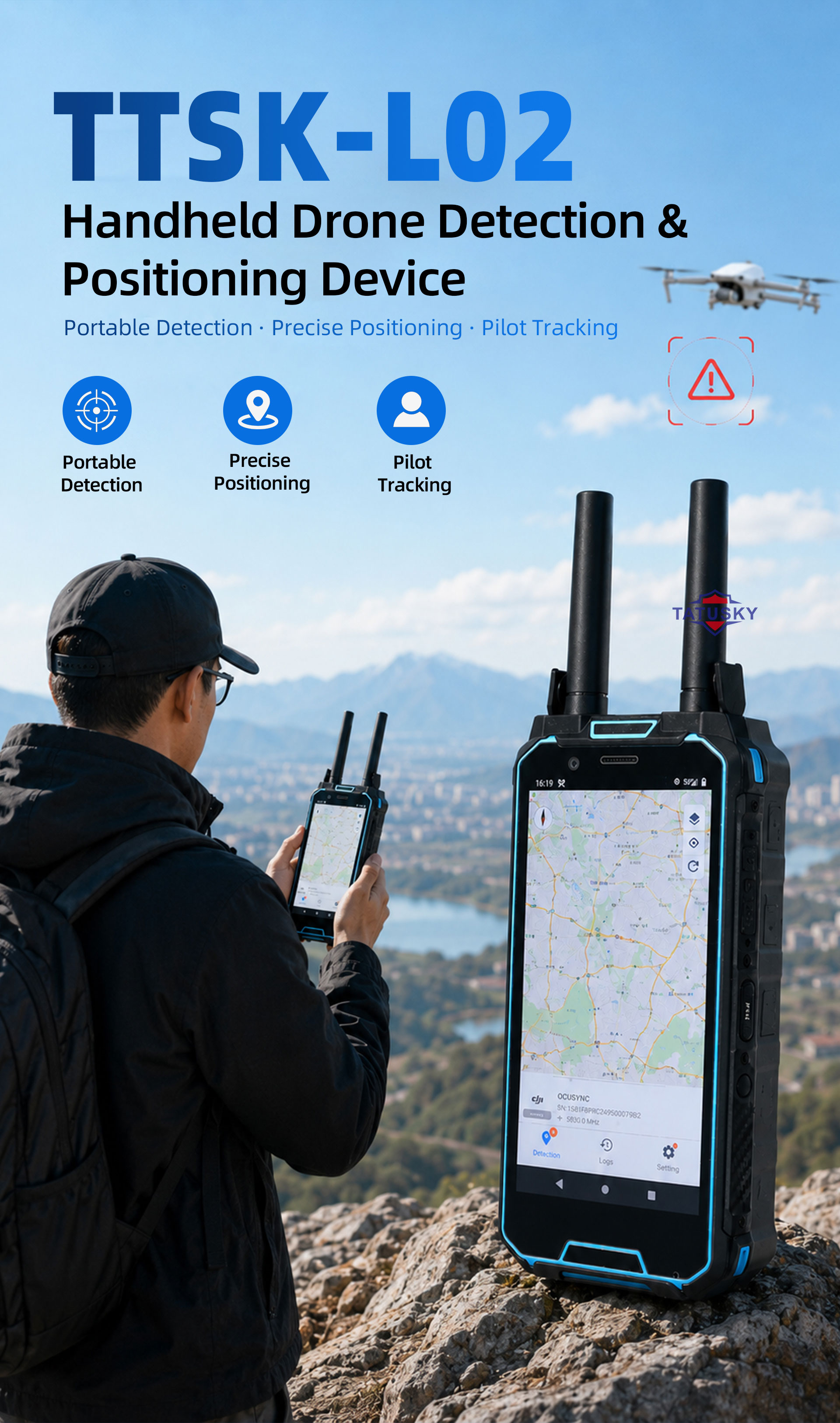
Handheld UAV Detection And Positioning Equipment – TTSKL02
Product Overview
The TTSKL02 is an advanced handheld counter-UAS solution engineered for the detection and geolocation of unmanned aerial vehicles, with particular emphasis on identifying low-frequency FPV racing drones. By analyzing and decoding FPV video downlink signals in real time, it significantly enhances situational awareness and threat identification capabilities in complex airspace environments.
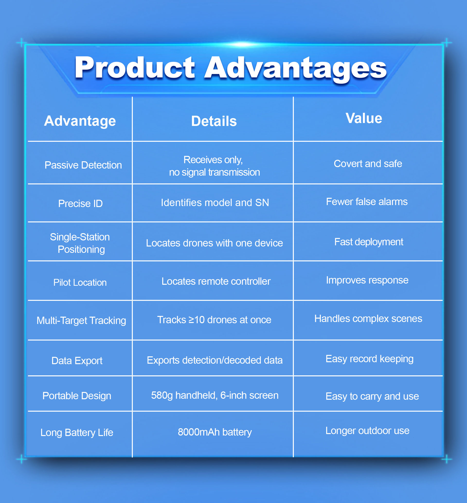
This compact, all-in-one unit integrates multiple core functions—spectrum scanning, protocol parsing, Remote ID (RID) interception, and compliance verification—into a single lightweight platform. Weighing just approximately 650 g, it offers exceptional portability for field operations. The system provides instantaneous detection and early warning for 900 MHz-band drones, while simultaneously pinpointing the real-time positions of both the UAV and its remote controller, enabling full-track target localization.
Designed for ease of use with extended battery endurance and an intuitive interface, the TTSKL02 is well-suited for a broad spectrum of low-altitude security missions, defense operations, and counter-drone deployments, including mobile patrols and quick-reaction force scenarios.
Key Capabilities
Drone Geolocation – Precisely determines the position of detected UAVs and visualizes them as dynamic aircraft icons on the built-in electronic map for instant spatial awareness.
Controller (Pilot) Positioning – Accurately identifies and locates the ground-based remote control unit, with pilot positions clearly marked as distinct controller icons on the map interface.
FPV Drone Recognition – Effectively detects custom-built FPV racing drones, with live decoding and analysis of their video transmission feeds for rapid threat assessment.
Pilot Approach Guidance – Automatically computes and displays optimal routing directions, assisting field operators in efficiently tracking and closing in on drone pilots with minimal effort.
Remote ID & Protocol Interception – Supports identification of DJI OcuSync-enabled aircraft, RID-compliant drones, and Wi-Fi-connected UAVs, with unique serial number (SN) recognition for individual unit traceability.
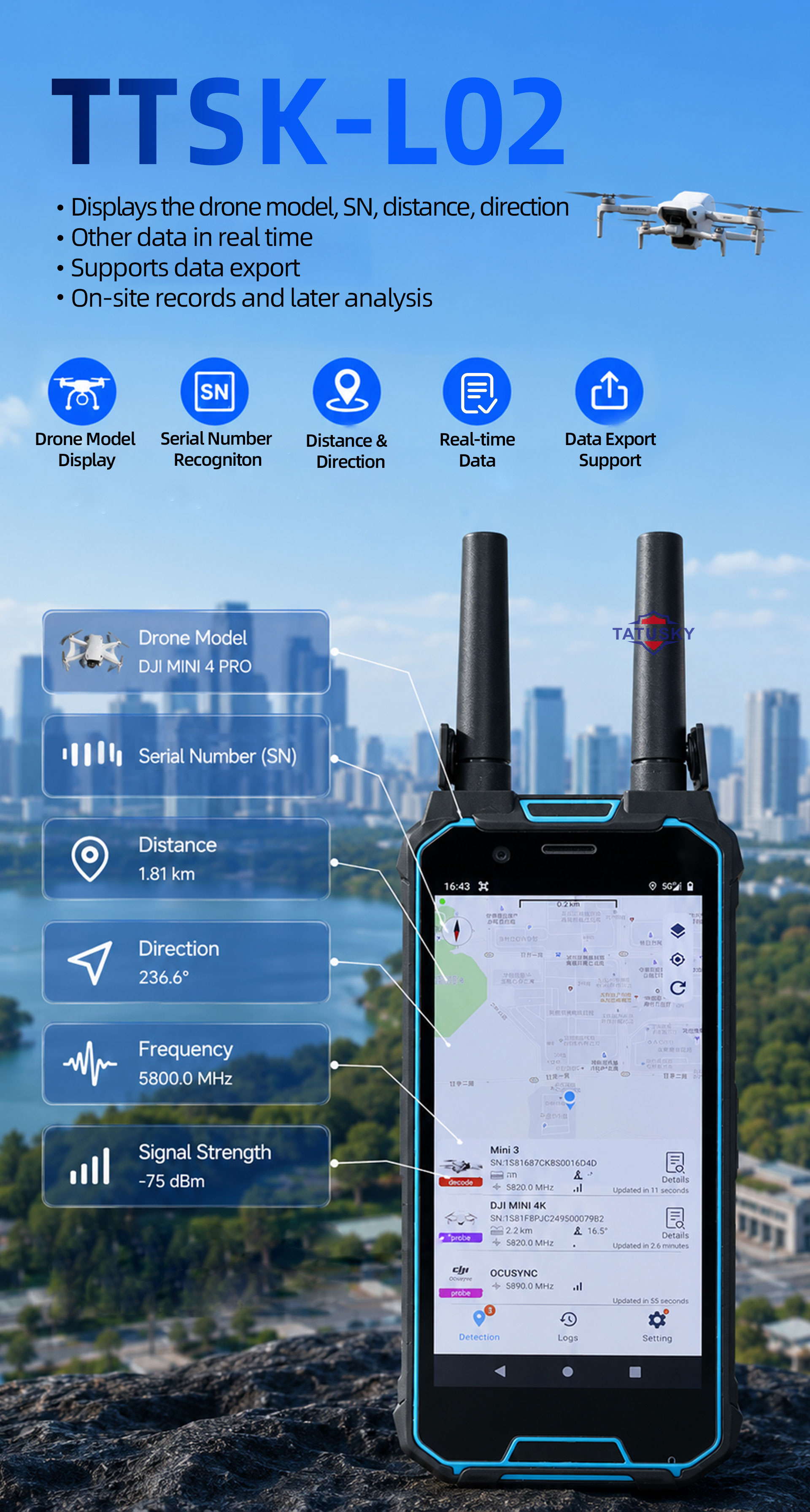
Comprehensive Real-Time Dashboard – Presents a full suite of operational data, including drone model, GPS coordinates, flight speed, altitude, pilot location, frequency band, and other mission-critical parameters.
Dynamic Allowlisting/Blocklisting – Offers flexible blacklist and whitelist configuration; whitelisted drones are automatically suppressed from triggering alarms, reducing false positives.
Instant Alerting Mechanism – Delivers immediate operator notifications via audible tones or haptic vibration feedback upon any unauthorized or suspicious UAV detection.
Flight Path Replay – Enables post-mission review with full trajectory playback functionality, supporting debriefing, analysis, and forensic investigation.
Automatic Logging & Audit Trail – Securely stores all detection events with comprehensive records, including SN, drone model, frequency usage, timestamps, and other critical metadata for full traceability.
Multi-Language Interface – Available in English, Chinese, Russian, and Portuguese to support global operational deployment.
Technical Parameters
|
Item |
Performance Index |
Indicator Parameters |
Remarks |
|
1 |
Detection frequency band |
100MHz~6GHz |
|
|
2 |
Detection radius |
1.5~2km (urban environment) 2~3km (open area environment) |
|
|
3 |
Response time |
3~ 5s |
|
|
4 |
Positioning range |
1~2km (urban environment) 2~ 3km (open area environment) |
|
|
5 |
Detect the quantity |
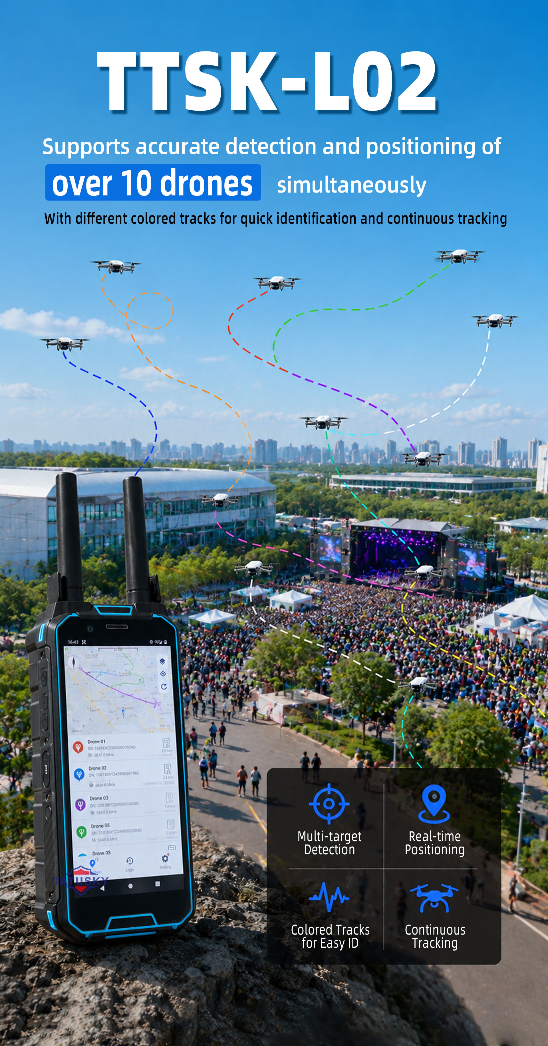
≥10 sorties (simultaneously) |
|
|
6 |
Time of endurance |
3~ 4h |
|
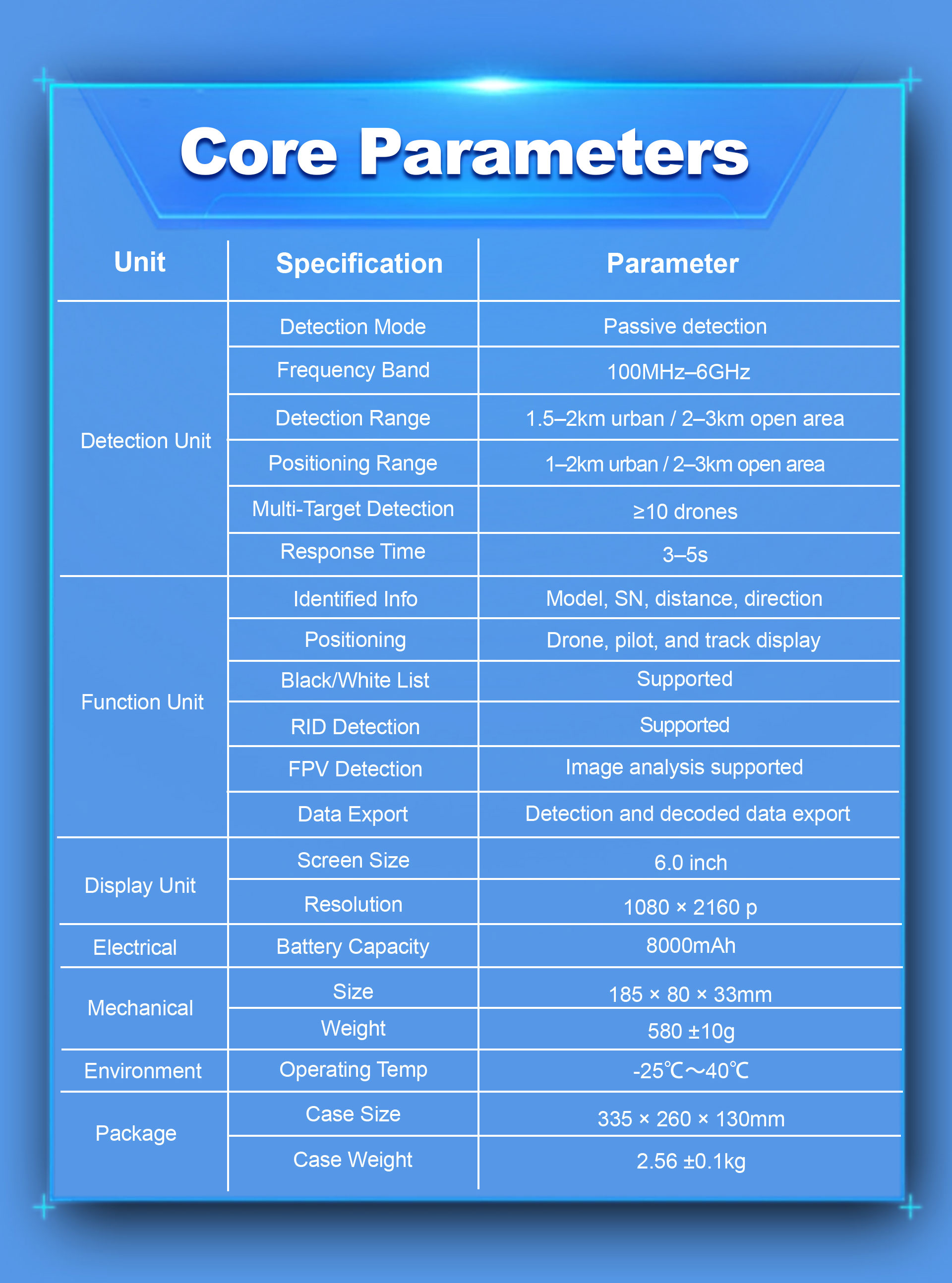





The L02 can detect and identify a wide range of drones, including DJI drones, Wi-Fi-based UAVs, FPV drones, and many other common commercial drone models operating within the supported frequency range.
The typical detection range is up to 1.5–2 km in urban environments and up to 2–3 km in open areas, depending on terrain, signal conditions, and electromagnetic interference.
Yes. The L02 supports drone positioning and pilot (remote controller) positioning for supported drone communication protocols, displaying their locations on the built-in electronic map.
Yes. The device supports Remote ID monitoring and can recognize drones broadcasting standard RID information, helping users identify compliant UAVs in the area.
Yes. The L02 can detect and identify FPV drones and analyze FPV transmission signals in real time, enhancing situational awareness during drone monitoring operations.
The system can detect and monitor more than 10 drones simultaneously, providing real-time information for multiple targets within the coverage area.
No. The L02 supports standalone offline operation. Network connectivity is optional and can be used for additional features such as device-to-device communication.
The built-in 8000 mAh battery provides approximately 4–6 hours of operation under normal usage conditions. Battery life may vary depending on screen brightness and operating environment.
Yes. The device supports detection record storage and flight track playback, allowing users to review historical drone activity and analyze previous flight routes.
The L02 is suitable for event security, critical infrastructure protection, airport monitoring, border security, industrial facilities, law enforcement support, and general drone awareness operations where real-time drone detection and tracking are required.


